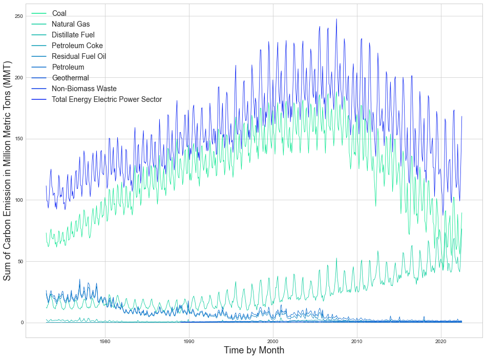
Analysis and Forecast of the U.S. Energy CO2 Emissions
Machine Learning, Time-Series Analysis
Python
Machine Learning, Time-Series Analysis
Python
Interactive Online Dashboard
Python with Panel/Hvplot
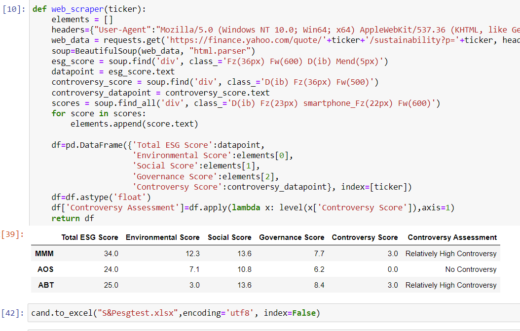
BeautifulSoup, API
Stored into a Complete Excel Dataset
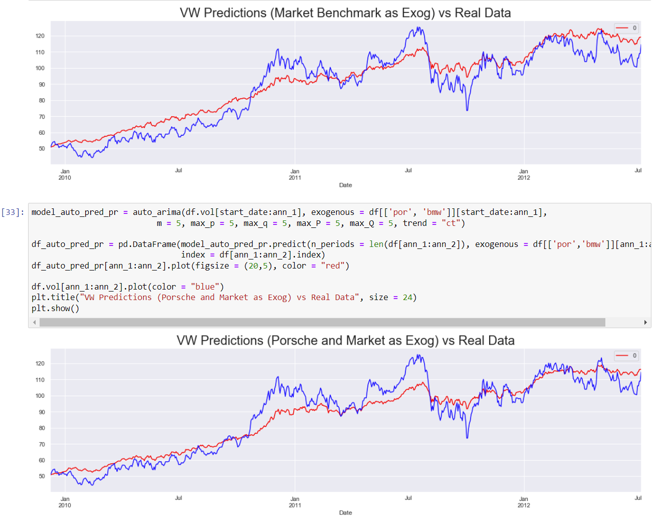
Machine Learning, Time-Series Analysis
Python
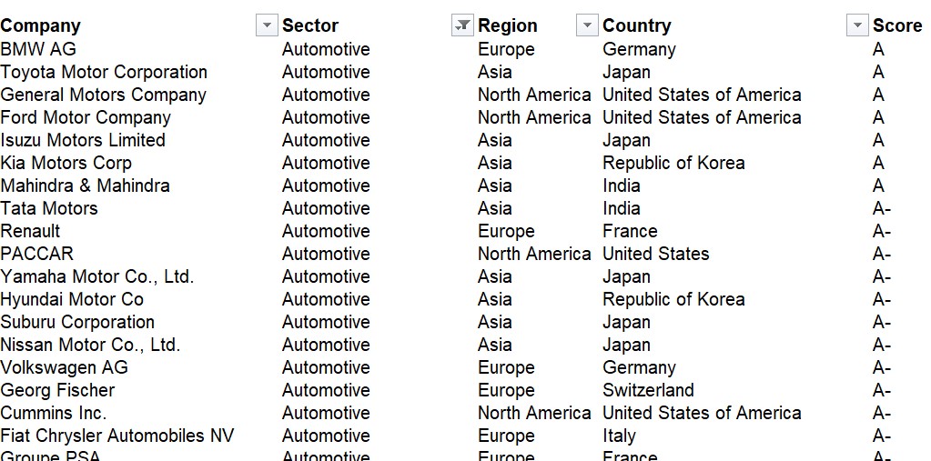
Excel, Data Analysis
CDP Database, Consulting Service
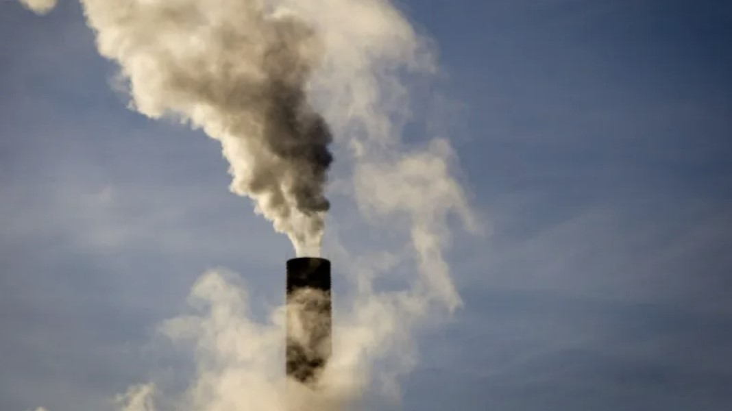
ABM Simulation Model
Undergoing
Geospatial Analysis, Multi-dimensional Data of Sea Surface
ArcGIS
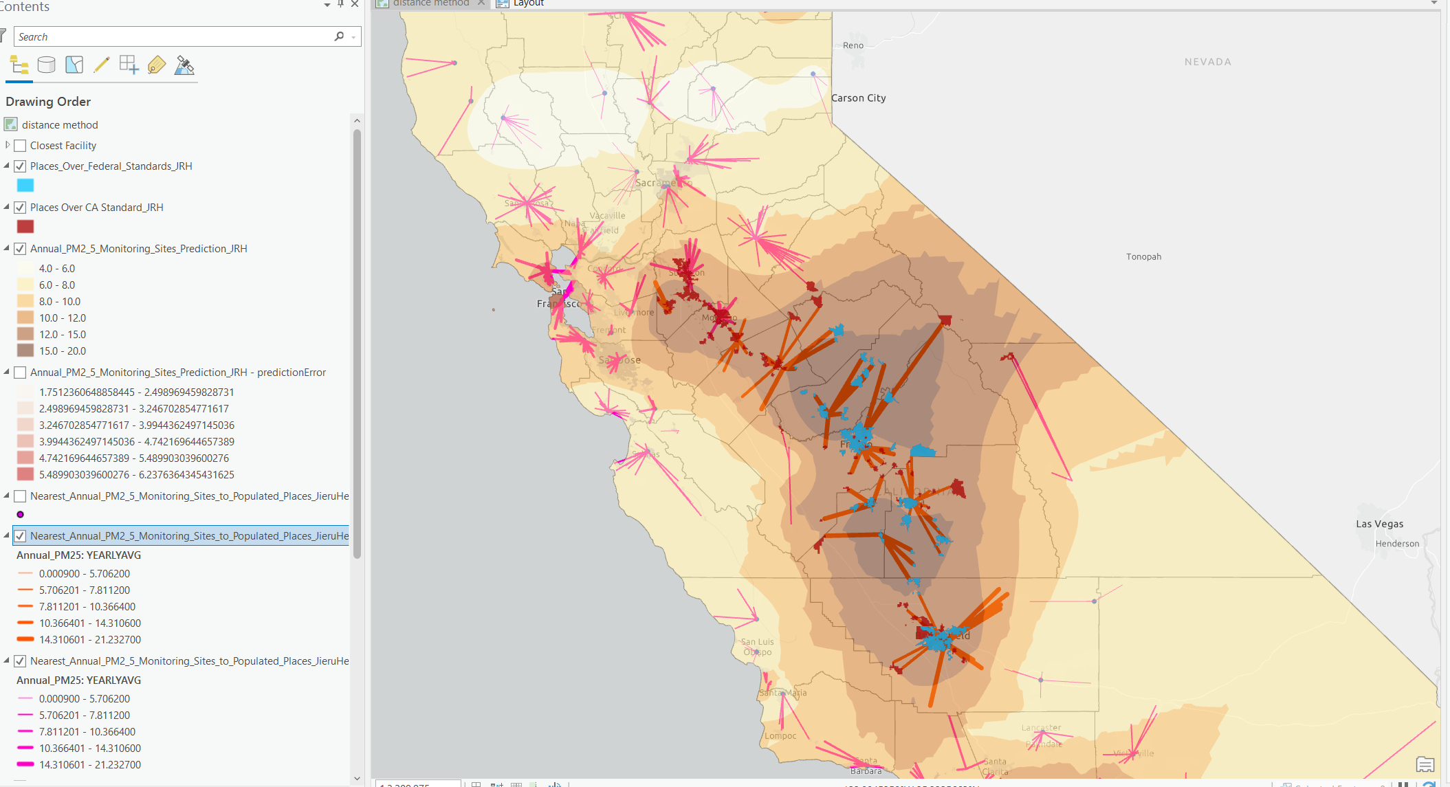
Geospatial Analysis
ArcGIS
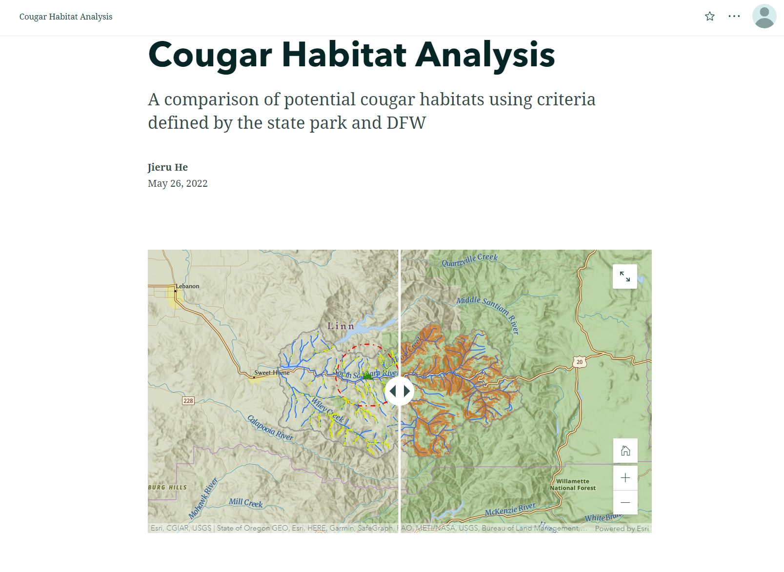
Geospatial Mapping and Comparison
ArcGIS StoryMaps
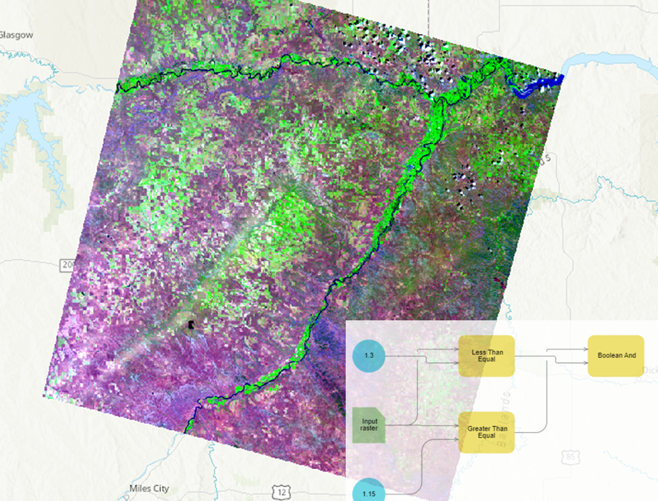
Raster Analysis
ArcGIS Image for ArcGIS Online

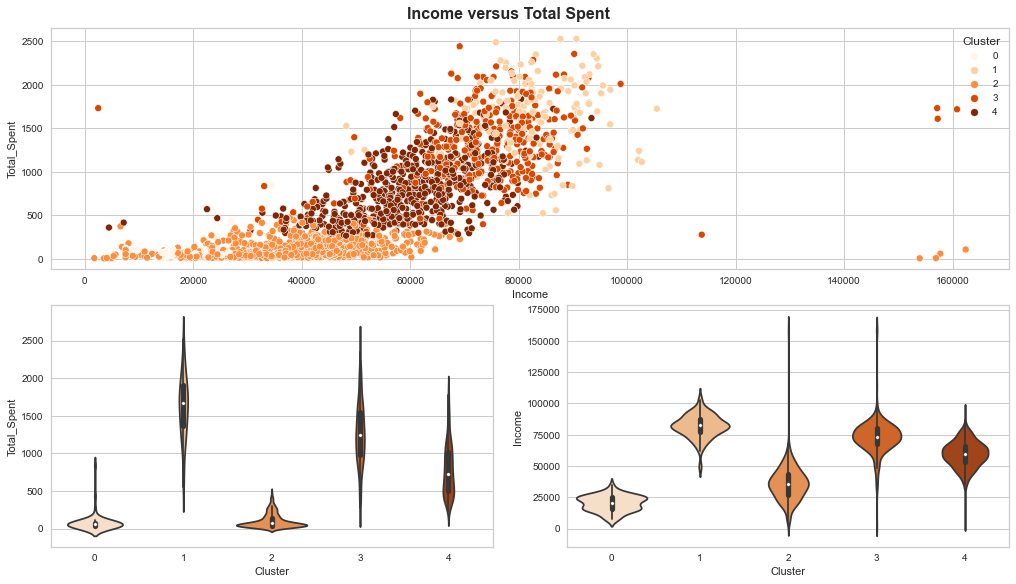
Machine Learning, Clustering
Python
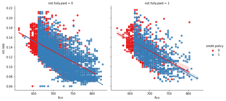
Complete Modeling Process of PD, LGD, EAD
Python
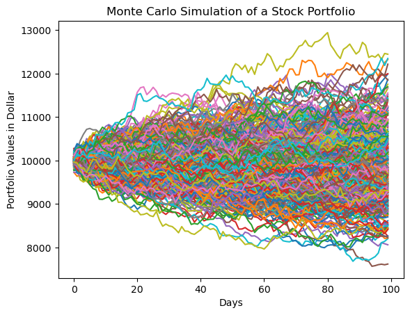
Monte Carlo Simulation
Python
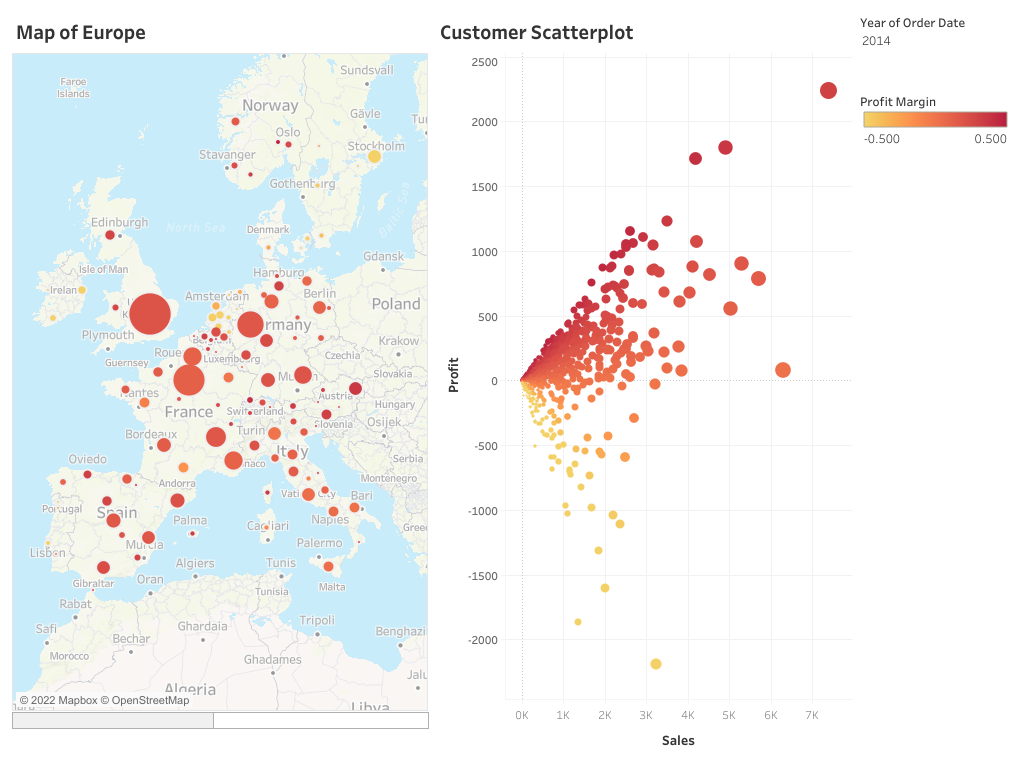
Data Visualization
Tableau
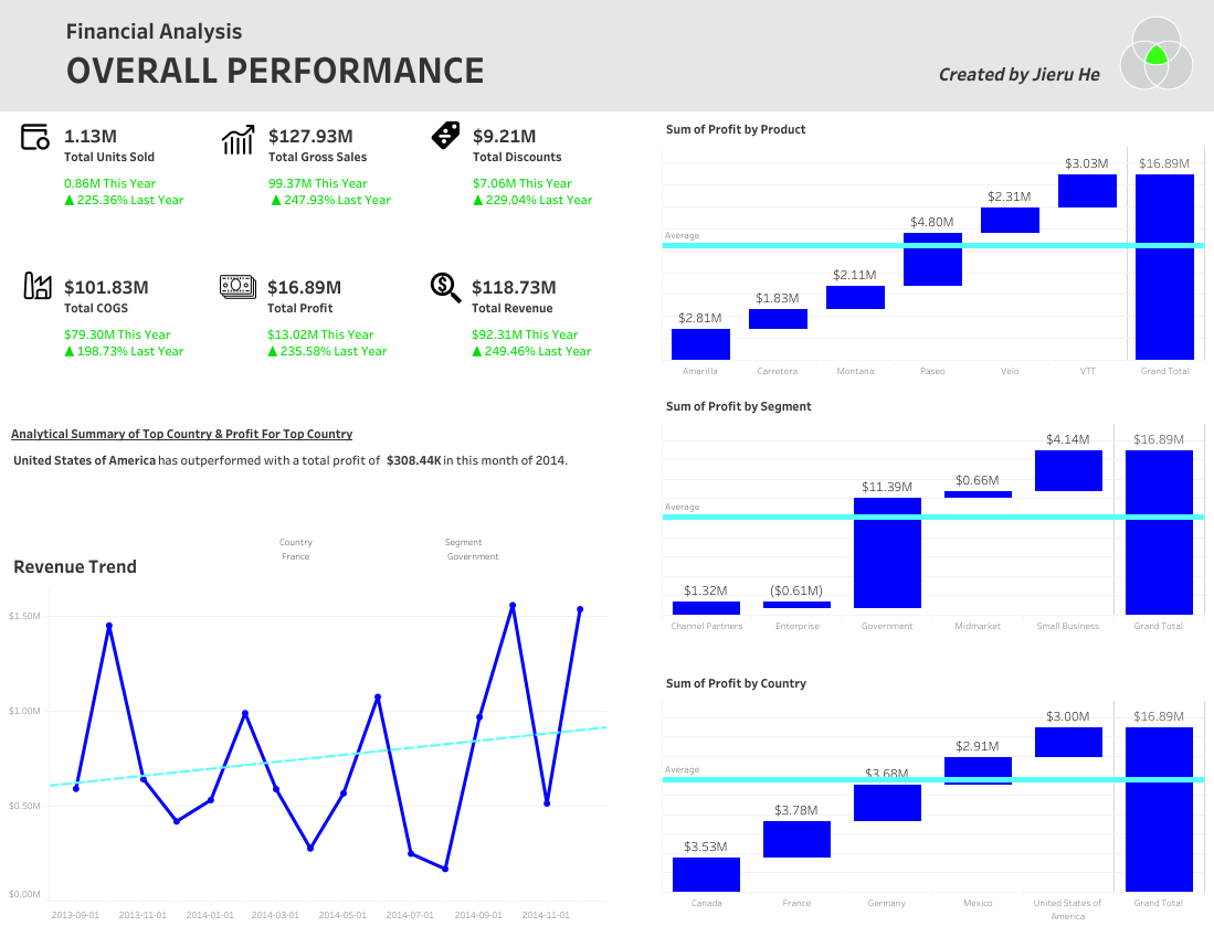
Data Visualization
Tableau
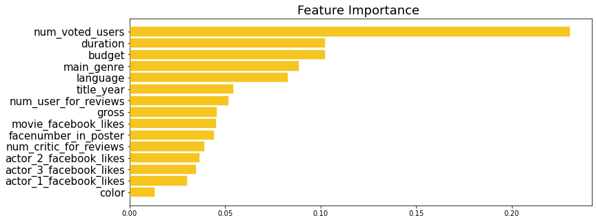
Machine Learning, Regression and Classification
Python
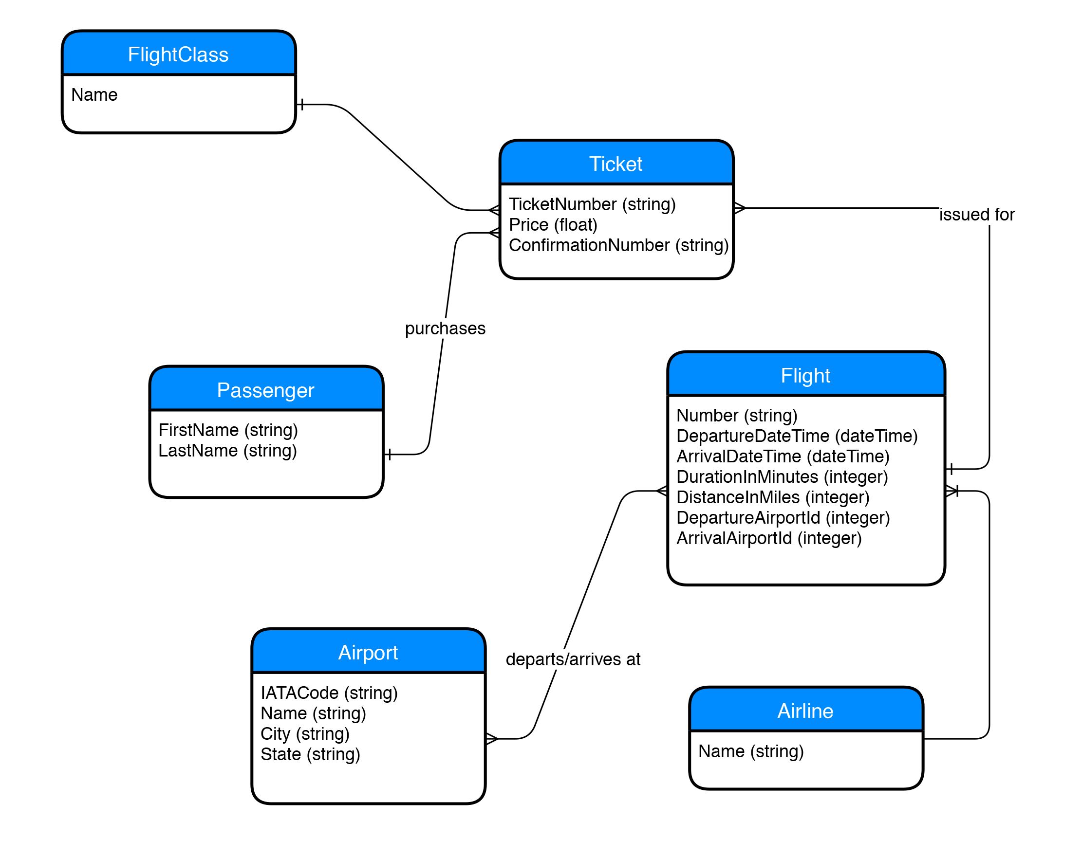
Database
MySQL Workbench
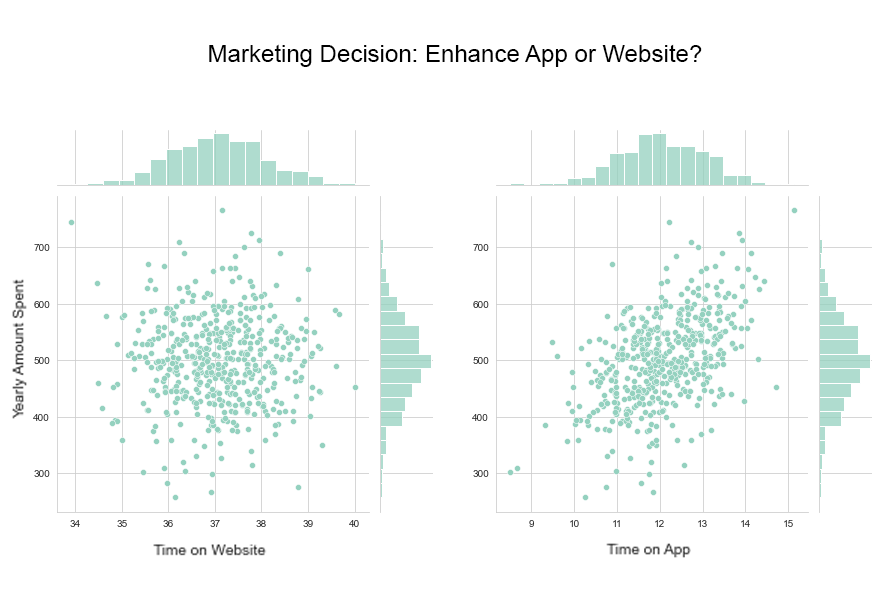
Machine Learning, Regression
Python
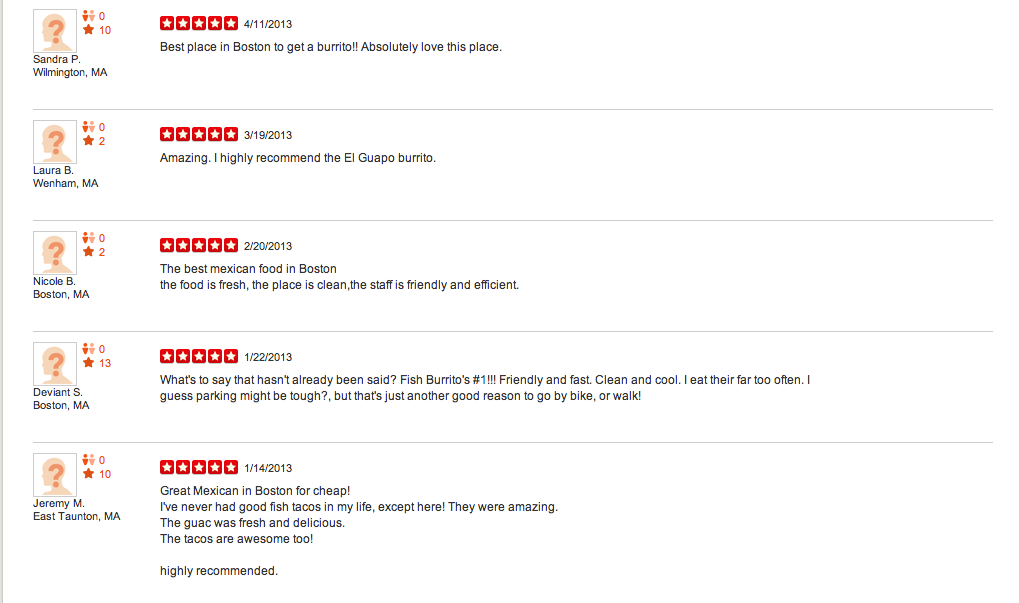
Natural Language Processing
Python
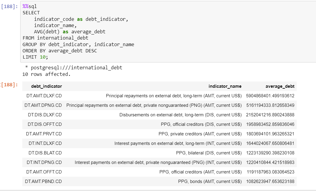
SQL Query
PostgreSQL
Data Visualization, Tableau
Work Inspired by Hans Rosling of the Gapminder Foundation
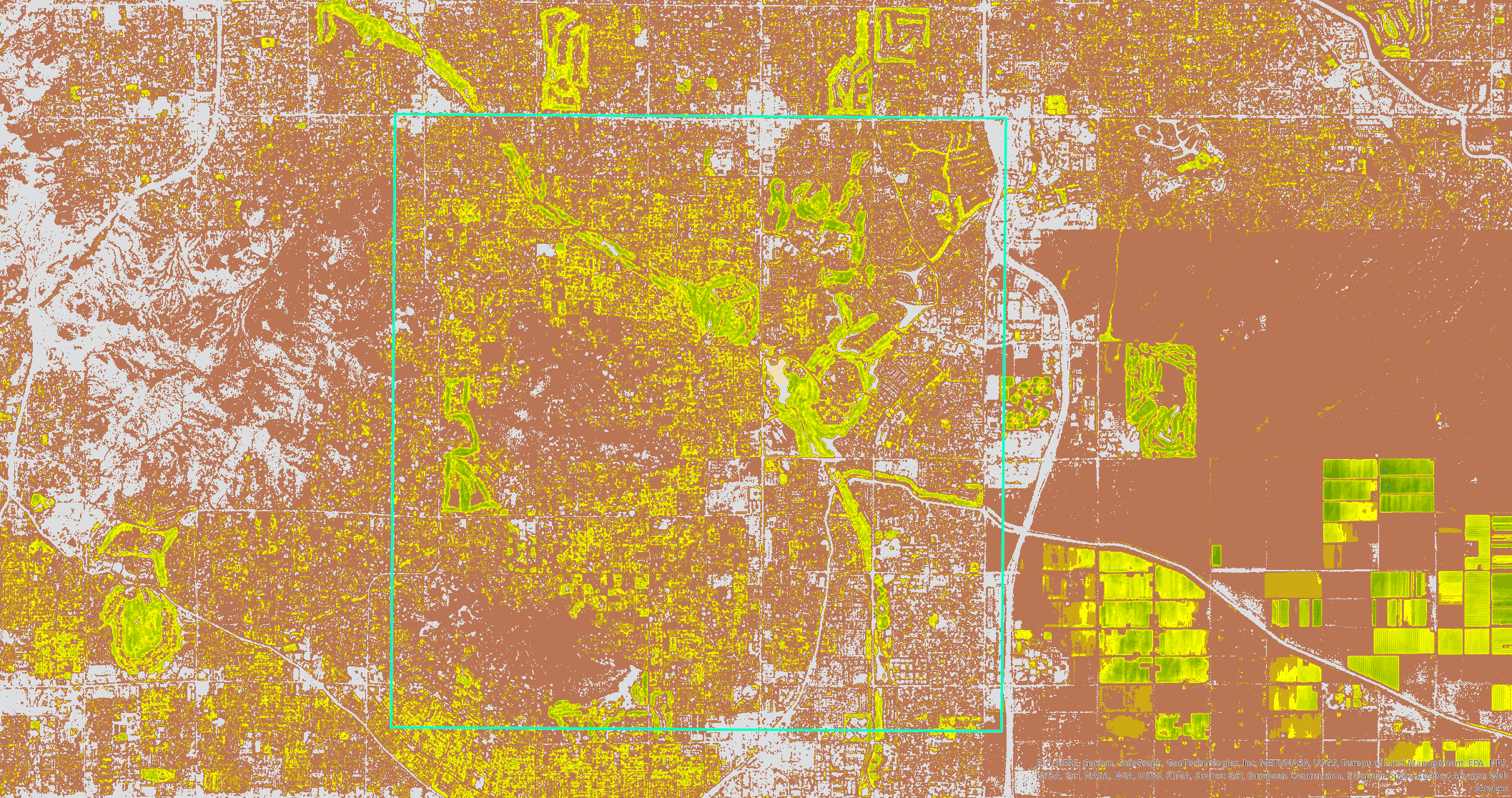
Landsat Explorer App, ArcGIS Online, ArcGIS Living Atlas
ArcGIS Pro
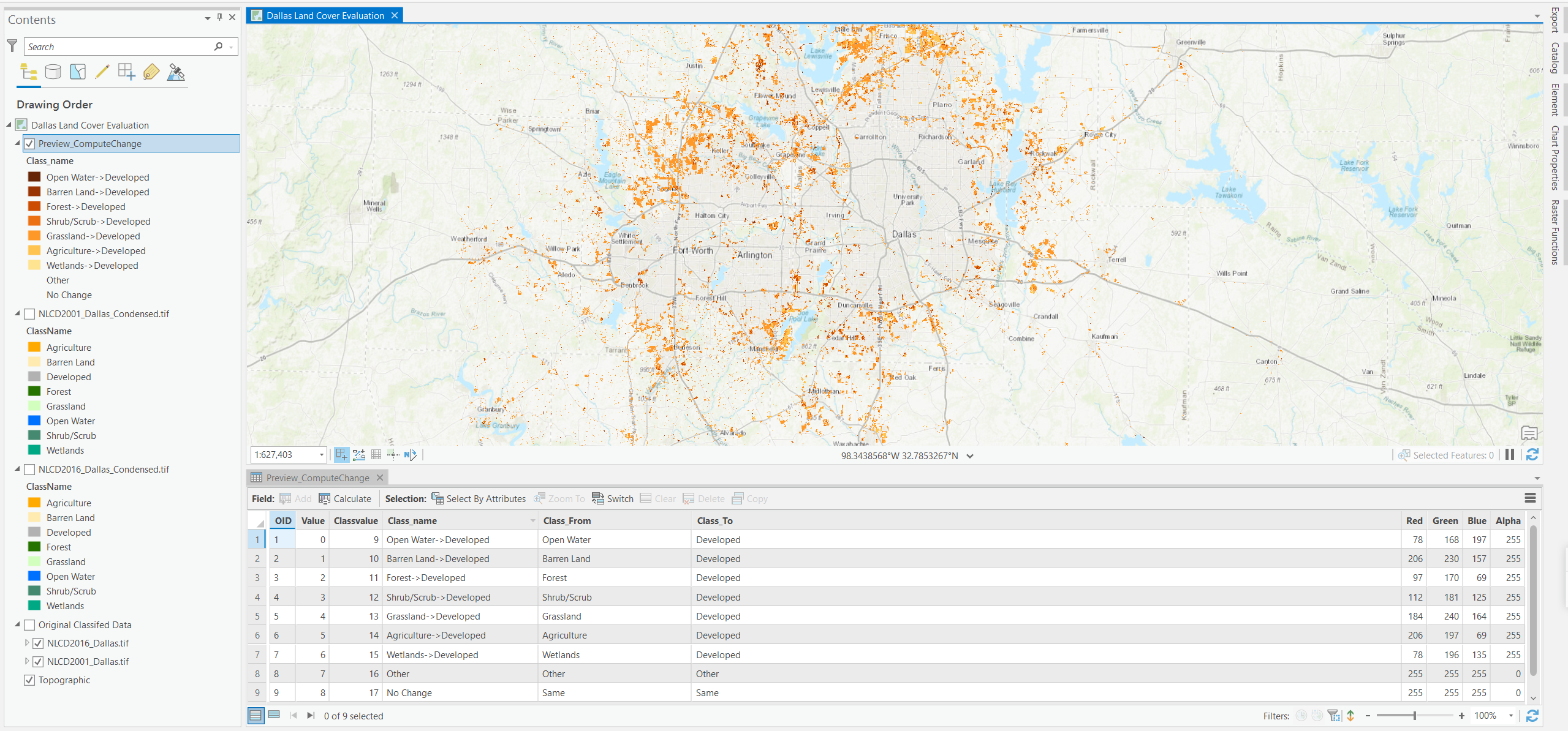
Geospatial Analysis
ArcGIS Pro
Choropleth Map, Interactive Visualization
Python Plotly
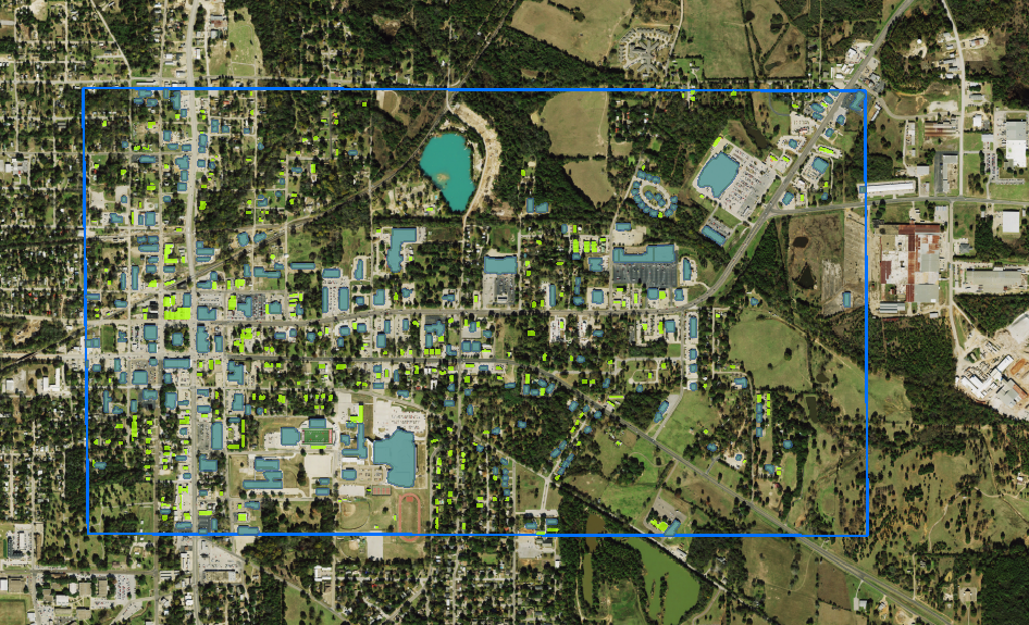
Geospatial Analysis
ArcGIS Image for ArcGIS Online with Deep Learning Models
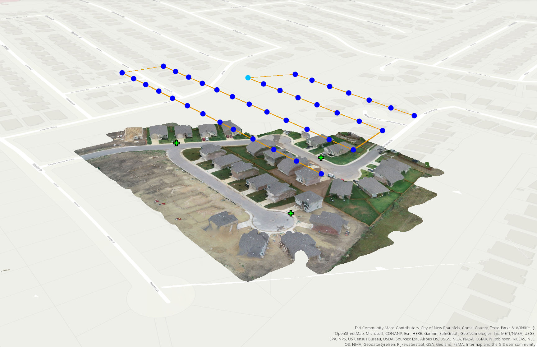
Drone Data and Imagery Creation
ArcGIS Drone2Map

Web Development
Flask, SQLite Database
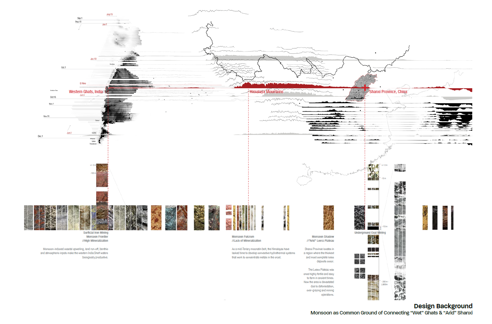
Western Ghats, India and Shanxi Province, China
Published on Leading Landscape Architecture Journals
Conducted Multi-disciplinary Research
Research, Field Trip, Collaboration with Abroad Universities
Advised Sustainability and Resilience Development Solutions on Natural Resources Depleted Regions
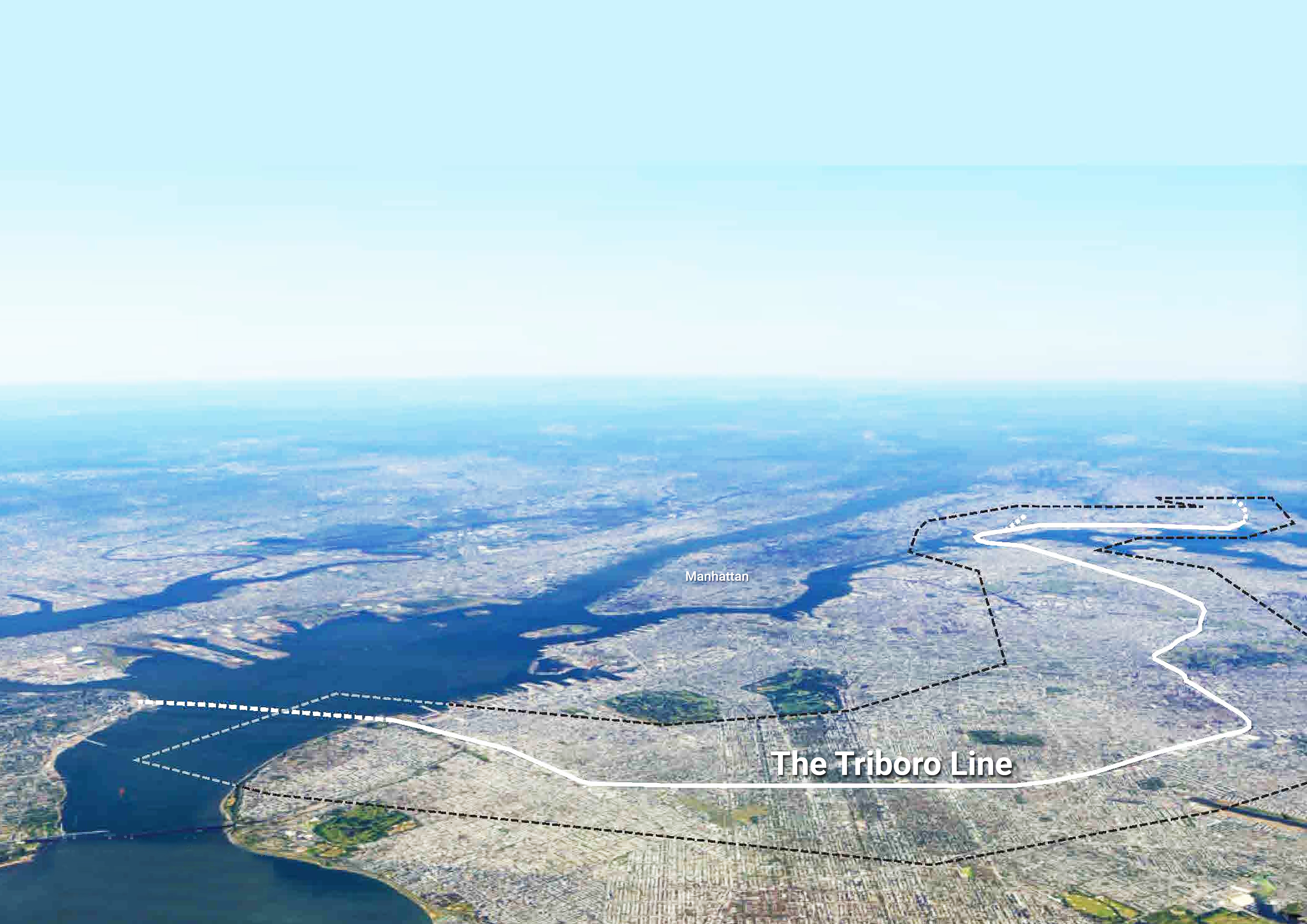
Resilience Planning
ArcGIS, Adobe Suite
Led Resilience Planning and Team Coordination Work
AutoCAD, Rhino, ArcGIS, Adobe Suite
Led Graphics and Sustainable Design Solutions
AutoCAD, Rhino, ArcGIS, Adobe Suite
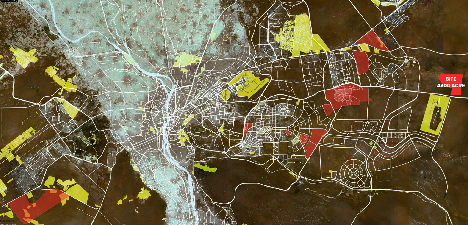
Provided Project Administrative Support
Site: Cairo, Egypt
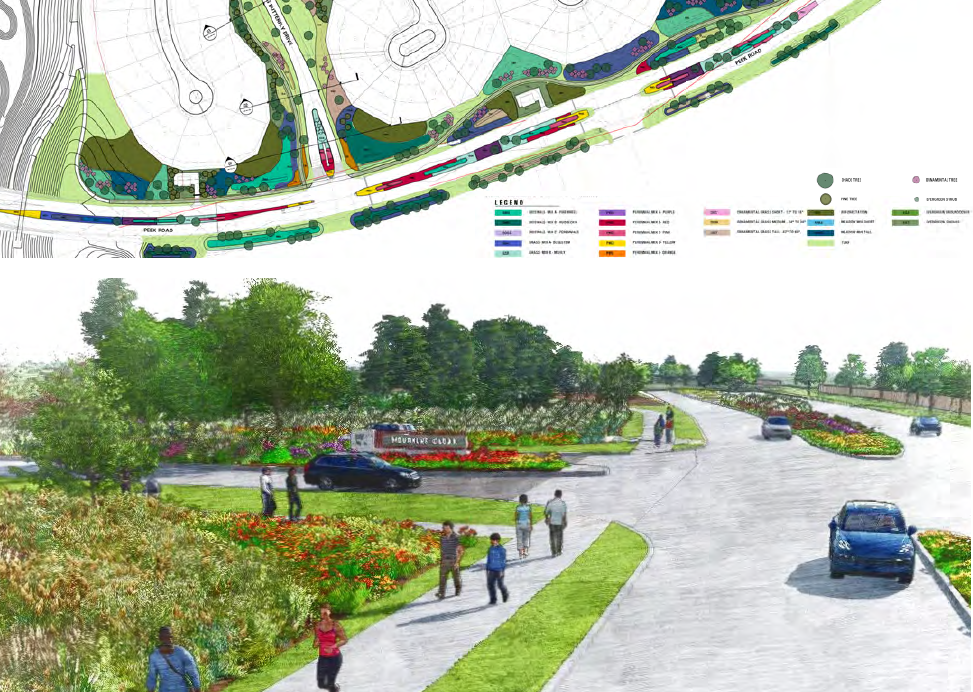
Construction Documentation
AutoCAD
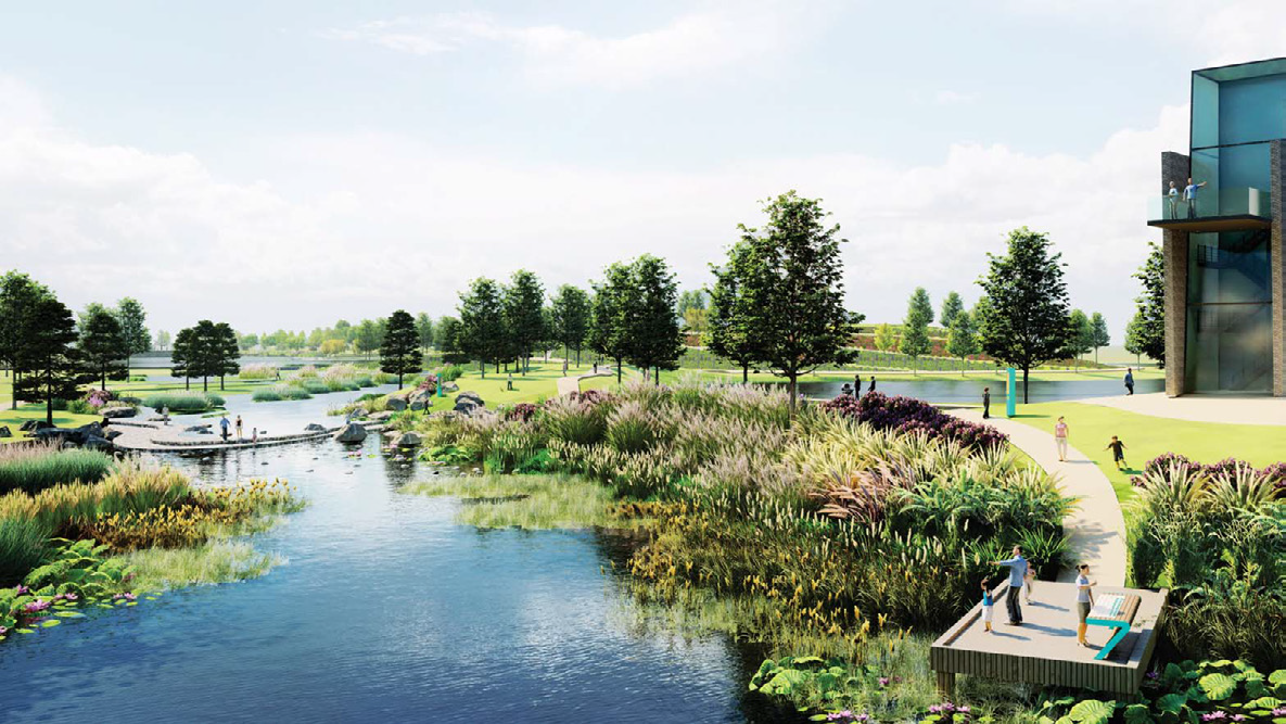
Concept Design, Water System Design
Rhino, Lumion, Adobe Photoshop
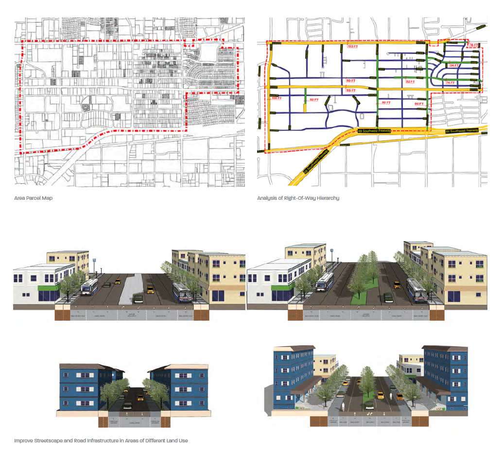
Urban Planning and Design
Sketchup, Adobe Photoshop and Illustrator
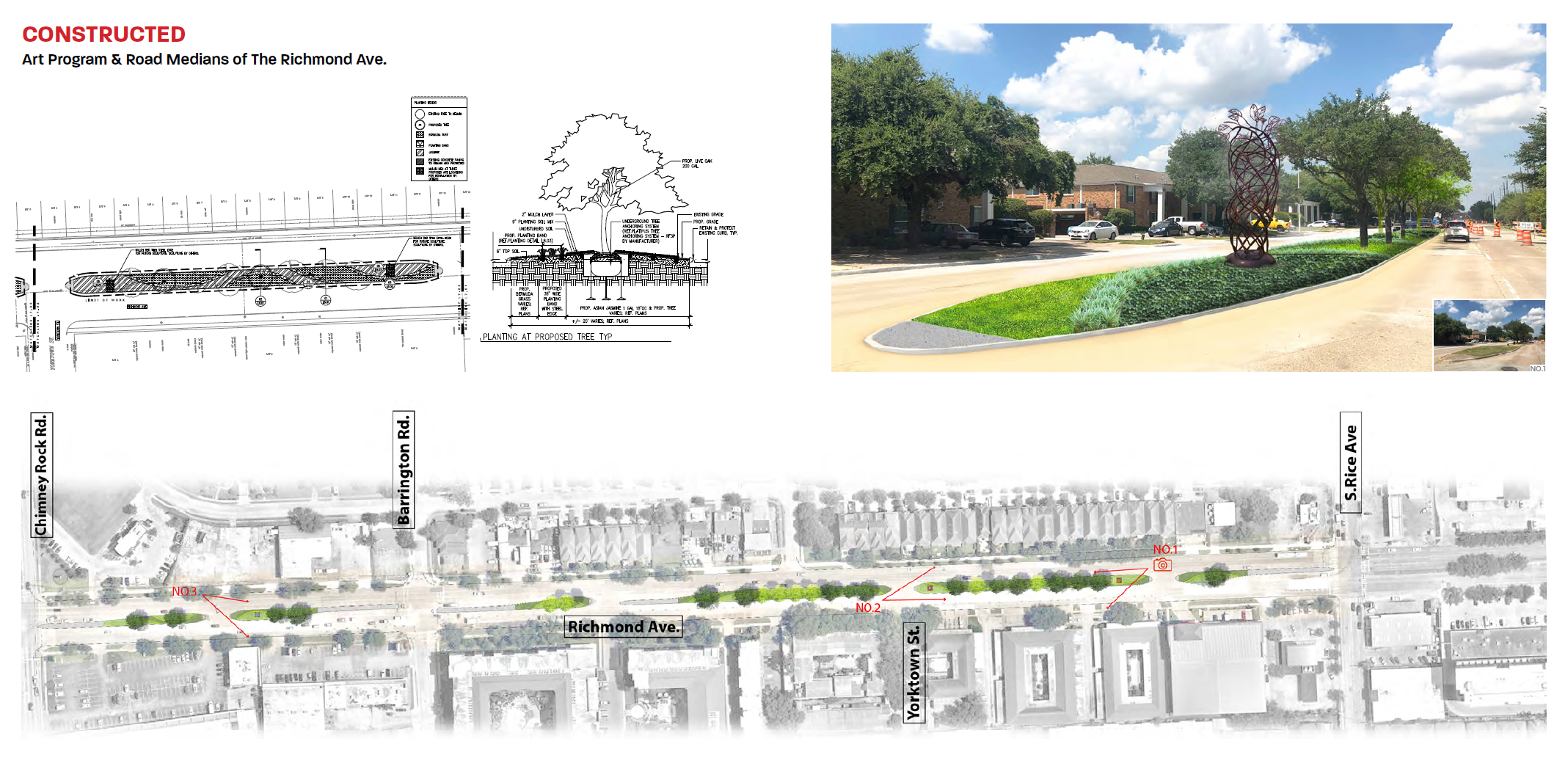
Construction Documentation
AutoCAD
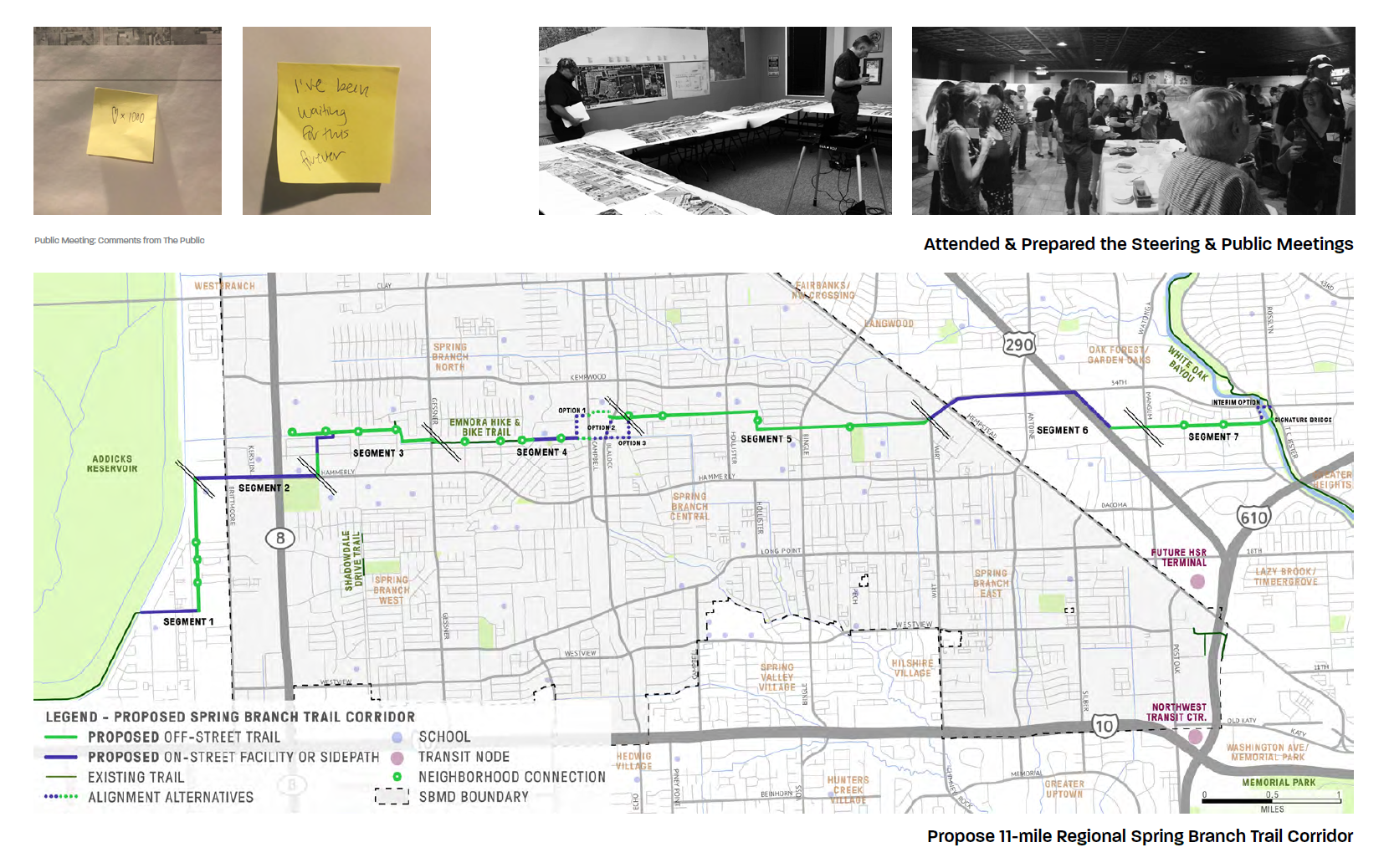
Urban Design and Research
AutoCAD, Adobe Illustrator
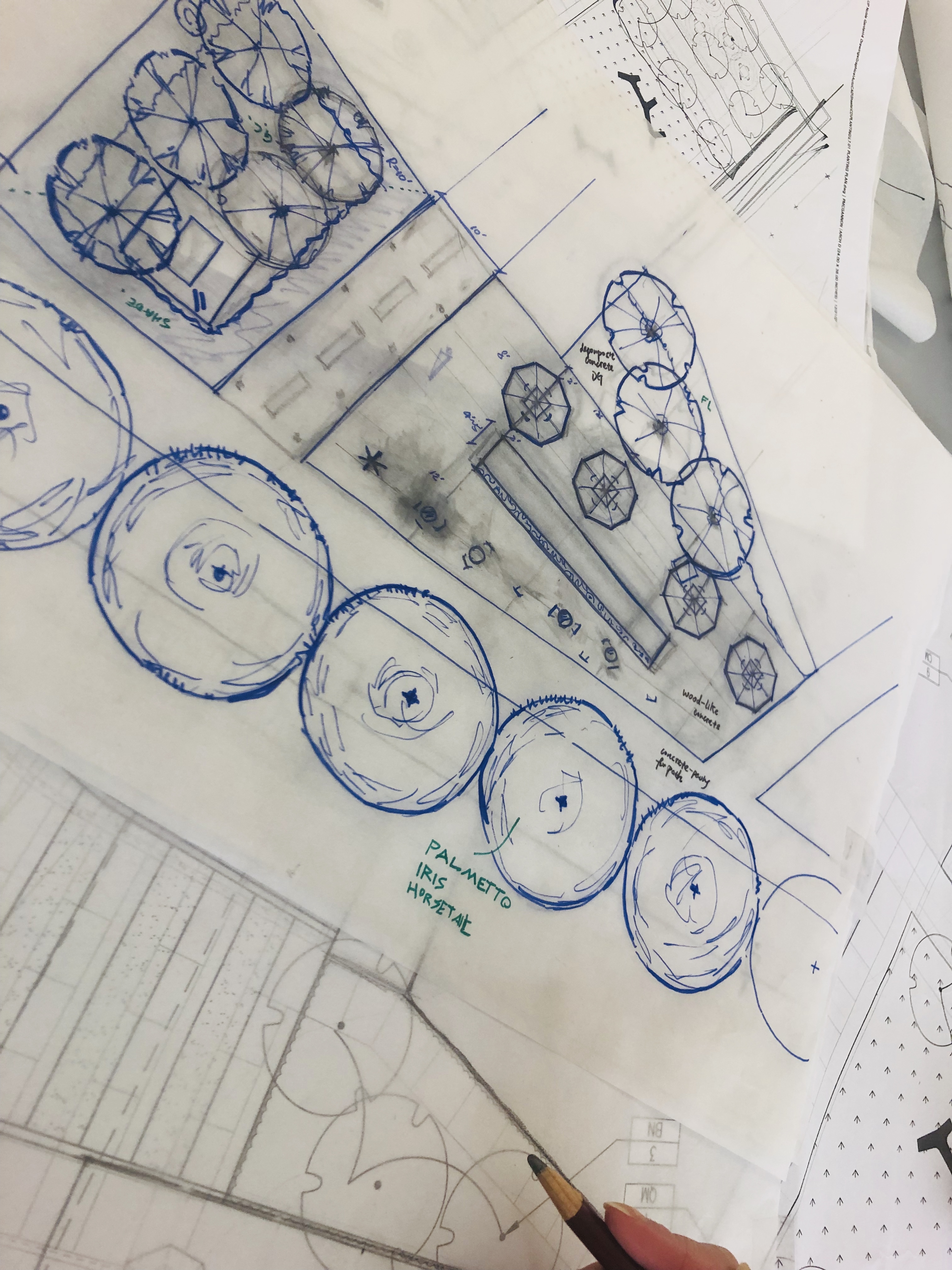
Sketch, Contruction Documentation
AutoCAD